BIRDY: celestial dynamics models applied to autonomous navigation
(report 2015)
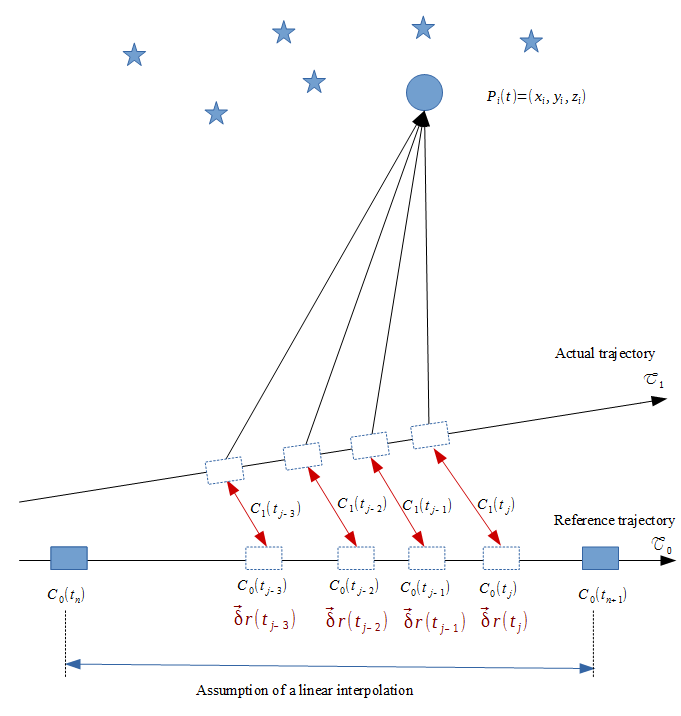
The BIRDY project responds to the problem of autonomous navigation. In general, the position of space probes is obtained mainly via the American Deep Space Network which must communicate regularly with the probe to follow its trajectory. Providing the sensors with an autonomous navigation system would be a source of significant savings, but still remains to be fully achieved. To date they can only autonomously determine their attitude, using star catalogs. It is only when approaching a previously mapped planet that the probe can position itself relative to the points of interest on this surface. It is therefore necessary to apply resources to develop total autonomy of navigation. To determine a positioning when in deep space, the use of triangulation including planets and nearby asteroids is proposed. The increase in accuracy of the ephemerides which provide very precise positions of these bodies, makes it possible to envisage a positioning in the space without the support of a terrestrial station. The method and its precision are at the stage of definition and detailed evaluation. Nanosatellite technology then have a major interest in order
Testing these methods in practice is of great interest for the development of nanosatellite technology, opening the way to the missions of tomorrow.

BIRDY is a CubeSat project developed between PSL universities in Paris and NCKU in Taiwan, and it has an important scientific goal in space weather. It is brought to France by IMCCE and LESIA. It is in the feasibility study phase for a mission-to-flight precursor mission profile on a GTO orbit in 2018.


